In Search Of The Highest Natural Points in New York City

One of my long-term life goals is to climb to the highest point in each state (only 48 left to go – looking forward to Florida’s 345 ft Britton Hill, not looking forward to Alaska’s 20,236 ft Mount McKinley). This past weekend, as I was considering where the next destination should be, it suddenly occurred to me that I had no idea where New York City’s highest points were.
And so putting off Massachusetts’ 3,489 ft. Mount Greylock for another day, I gathered my hiking gear and set out to conquer the highest peak in each of New York City’s five boroughs.
MANHATTAN
After acclimatizing for several hours in lower Manhattan, I trekked north to Washington Heights, to Bennett Park at West 183rd Street & Fort Washington Ave.
The highest point of land in Manhattan, the site was home to Fort Washington during the Revolutionary War, the base of operations for Washington. On November 16, 1776, British and Hessian troops seized the fort, forcing Washington’s army to retreat across the river into New Jersey. Today, cobblestones outline the original borders of the fort.
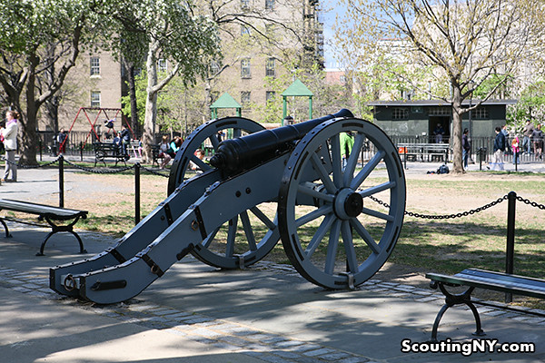
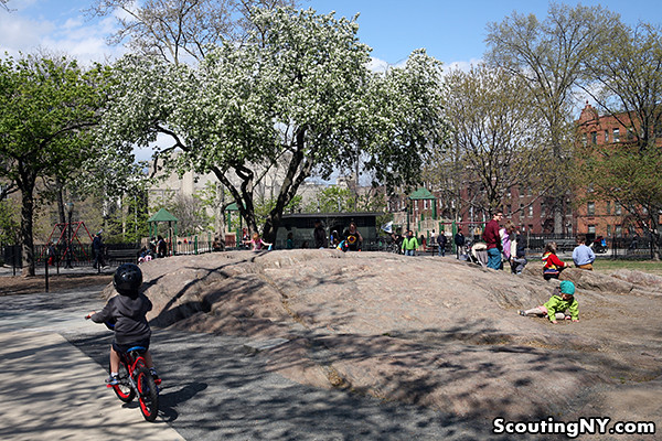
As for the actual highest point in Manhattan, I soon found a large chunk of exposed Manhattan schist at the western edge of the park. Tightening my steel crampons to my boots, I hiked past several several children and ascended the summit!
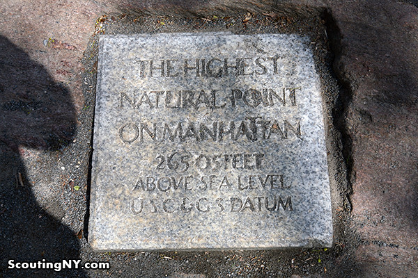
There’s an official plaque set into the rock, marking it as 265.05 feet above sea level (yes, that’s .05 feet, as in 3/4ths of an inch).
After taking in the gorgeous panoramic view of apartment buildings, I had to be off to my next destination…
THE BRONX
Barely surviving my passage across the treacherous Spuyten Duyvil Creek, I traveled further north to the very upscale neighborhood of Fieldston in Riverdale:
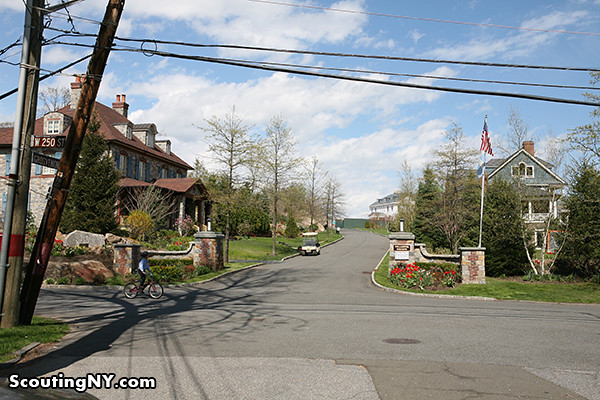
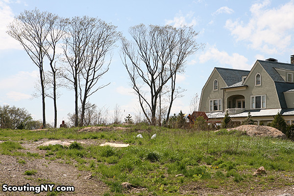
Once known as Delafield Woods after the original landowner, Fieldston today is a privately owned neighborhood of about 250 residences. To reach the highest elevation point, I switched to bottled oxygen and hiked up Grosvenor Avenue…

…arriving at a development in the midst of construction.
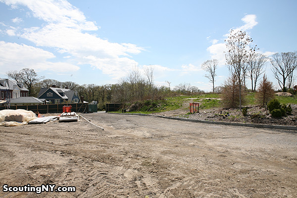
There are some pretty amazing views from the top. Sadly, there’s no plaque for highest elevation…
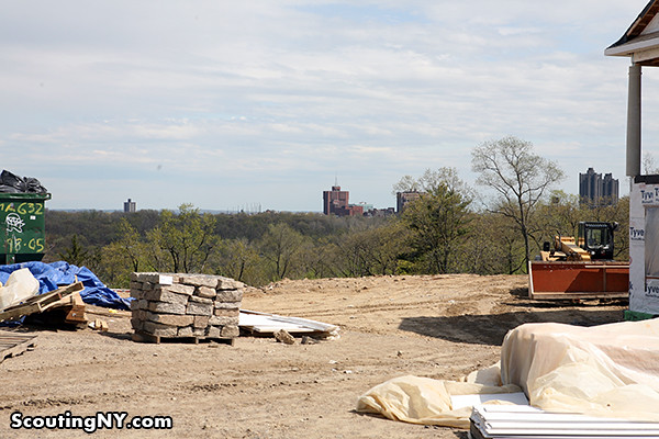
…but according to my topographical research, it’s about here on this person’s property, clocking in at a whopping 280+ feet:
Feeling a nosebleed coming on from the altitude, I quickly descended and headed southwest to the next stop…
QUEENS
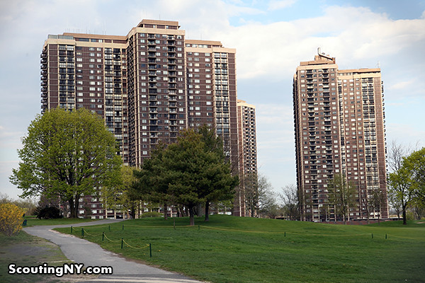
The highest point in Queens is actually a terminal moraine from the last Ice Age, marking the glacier’s furthest point of advancement. Today, it’s home to the North Shore Towers, a trio of 34-story apartment buildings built in 1971, complete with an 18-hole golf course and power plant.
Sadly, the trip to Queens’ highest elevation point turned out to be somewhat underwhelming. After hiking with my team of Sherpas along the Grand Central Parkway side road…
…we finally crested the summit!
Er, yes, this is it. Slightly disappointing, but a 258-foot hill is certainly nothing to scoff at from a mountaineering perspective.
While I was tempted to spend more time taking in the gorgeous alpine vista, it was late in the day, and we had to hurry on to the next stop…
BROOKLYN
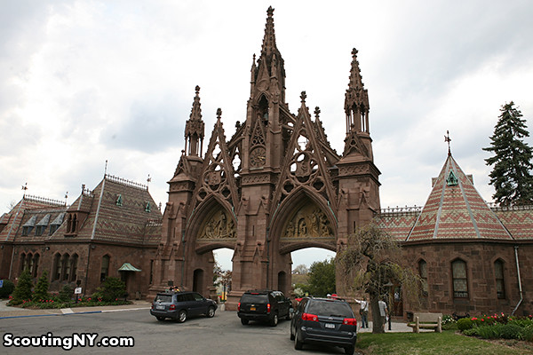
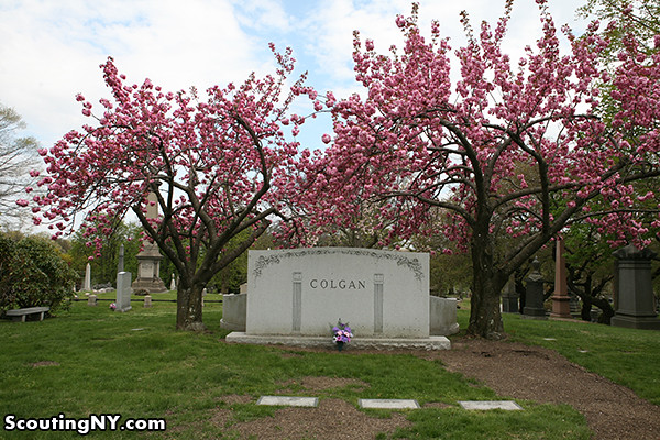
Thankfully, the main entrance to Green-wood Cemetery was a little more scenic.
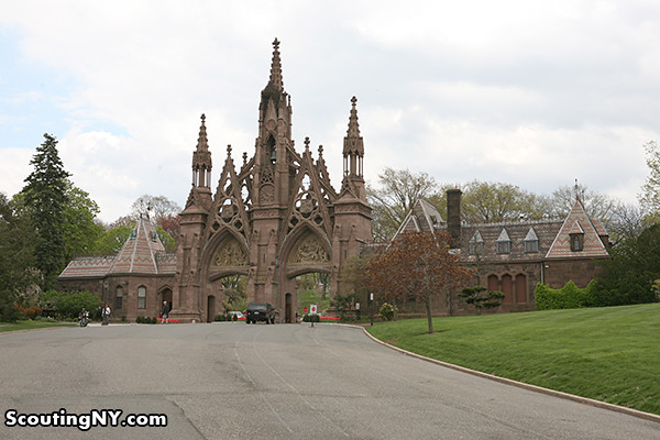
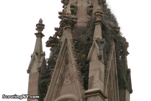
Built in 1861 in the Gothic Revival style, it was here that we spotted the most exotic animal species we were to come across on our expedition…
Brooklyn’s monk parrots, who nest very noisily in the spires (you can see a little puff of green below). According to legend, the birds escaped from a shipment at JFK in the 1960s and have been thriving ever since.
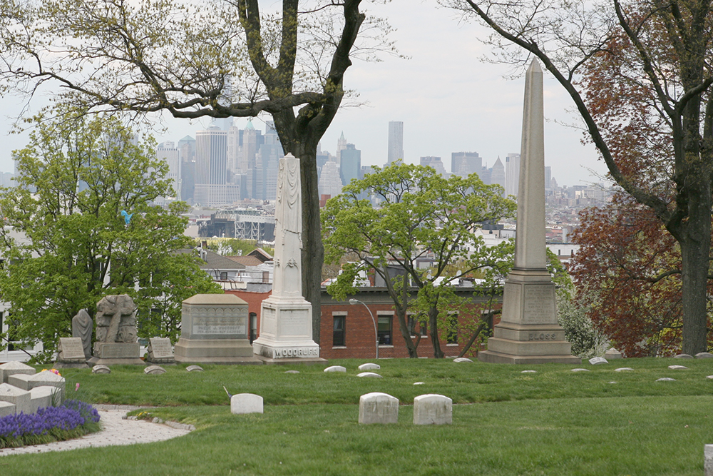
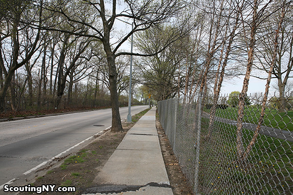
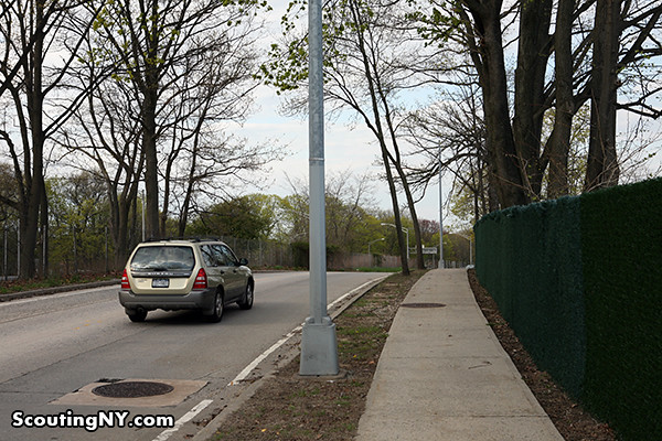
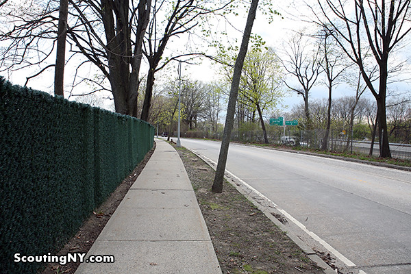
The highest point in Brooklyn can be found at Battle Hill, named for the fight that took place here during the Revolution, part of the greater Battle of Brooklyn.
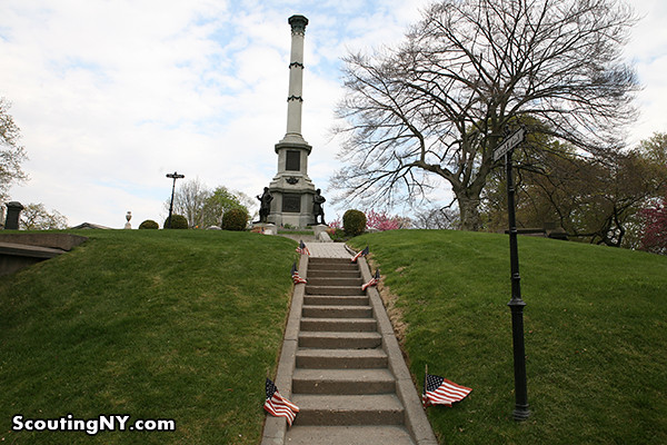
There are several landmarks near the summit worth noting, including the 1869 Civil War Soldiers’ Monument….
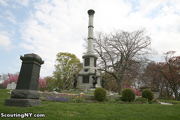
…and the nearby Minerva statue, a memorial to the Battle of Brooklyn (incidentally, waving directly at the Statue of Liberty):
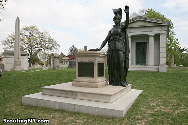
But my goal was the summit. Though a little wary of climbing without fixed ropes, I finally made it to the highest point in Brooklyn, located between these two trees at about 220 feet:
Quite the view!

Not wanting to be caught out in the elements after dark, I hurried on to my final destination…
STATEN ISLAND
Todt Hill (“tote”) is not only the highest natural point in all of New York City, it’s also the highest natural point on the Eastern Seaboard south of Maine. After looking at the map, Foster Avenue appeared to put me closest to the entrance…
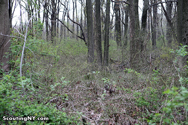
Todt comes from the Dutch word for “dead,” most likely in reference to how bare the hill once was due to its serpentine rock base, the high magnesium content of which hinders plant growth (thanks Redditor Captain Compost!). At first, it seemed as though it’d be a simple walk through the woods…
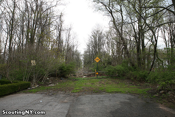
Unfortunately, the path quickly became treacherous.

While attempting to forge through the overgrowth, I very quickly became entangled in the horrible tangles of pricker bushes infesting the area, suffering several debilitating wounds that I feared might end the journey prematurely.
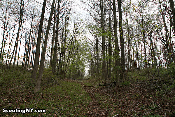
Finally, I broke through to an actual path, and made my way up the hill…
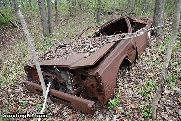
…passing something of a rarity for modern-day New York: an abandoned car!

In fact, there were several strewn about, dumped here God knows when:
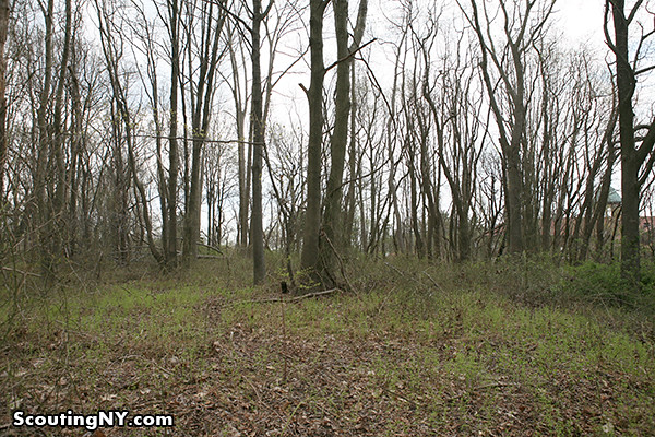
It’s a little hard to determine the exact high point, but this hill seemed to be the tallest around…
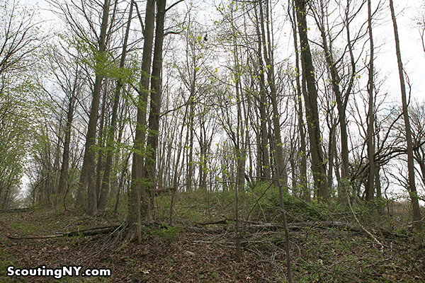
And at about 400 feet, I finally arrived at the highest natural point in New York City!
Five boroughs, five summits. While I can’t exactly say I recommend recreating this trip, it certainly was excellent preparation for my upcoming Mount McKinley climb.
Though I might start with that hill in Florida first.
-SCOUT
Great post! Last year, I decided that I wanted to get a beer and some food in each of the 5 boroughs in one day. I love challenges like this one! I may have to recreate it myself! I’ve already checked Todt Hill off the list and I live in Manhattan, so that one should be easy enough!
Kudos to you. Been in NYC my whole life, have never done all five boroughs in a single day. I’ve done four many times, but The Bronx always seems to be the elusive borough.
A few friends and I did the “Five Borough Bar Tour” about 6 years ago. We hit Glacken’s in the Bronx. http://www.yelp.com/biz/glackens-bar-and-grill-bronx
no wonder you can see north shore towers from miles and miles away. they look like the biggest thing in queens from a distance.
Does the rest of New York State not count as “Eastern Seaboard”? I would think that Mt. Marcy and other points in the Adirondacks are higher.
Honestly, I had the same reaction. I only included it because the NY Times deems it to be true – I think they mean it has to literally be on the water to count.
Exactly. It has to be on the seaboard itself, or within a few miles of it. NYS has some huge mountains, but nowhere near the seaboard. Todt Hill on Staten Island indeed wins this crown.
That “highest point on the Eastern Seaboard” claim is certainly up for debate. For most of my life, having spent many a childhood summer in the town of Highlands, NJ (near the entrance to Sandy Hook), I always recalled that the hilltop upon which the 152-year-old Twin Lights lighthouse was perched was referred to as the highest point, etc.
At 240 feet, it is obviously much shorter than many of the NYC spots, but, perhaps we should measure just how far from the shore each of these contenders is.
All in good fun, of course. I love NYC (have lived here my entire 62 years) and I love Highlands, NJ, for all the wonderful memories it has provided.
http://www.twinlightslighthouse.com/index.php?option=com_content&view=article&id=155&Itemid=228
https://en.wikipedia.org/wiki/Mount_Mitchill
Seaboard usually means any area fronting the ocean. Todt Hill on Staten Island definitely qualifies (it’s barely two miles from the Atlantic) and is over 100 feet higher than the Highlands in New Jersey. There is no debate; Todt Hill has been recognized as the highest area on the Eastern Seaboard (south of Maine) for quite some time now.
Let’s not split hairs. Marcy may be higher, but any hike in NYC is riskier.
Awesome post!! I live on Staten Island, so I “agree” about Todt Hill. Those abandoned cars were creepy though.
The first car looks like a 1970-71 Pontiac Gran Prix, the second is definitely a 1980-83 Dodge Mirada. One wonders how the hell they got so deep into the woods in the first place (if they were junkers, you couldn’t drive them in, no?). Luckily, you see very little of this on SI nowadays, so those cars must have been there for quite some time.
Those cars have been there since at least the late 80s. If you went a little further, there’s an abandoned house with a burnt out shell and a chimny remaining. At dusk, that gets really creepy.
I’ll take your word for it LOL. There’s a reason why so many low-budget horror movies are made on SI. It can get quite creepy in places.
A few years ago, our car was stolen from the Upper West Side and recovered in the outer reaches of Staten Island. The abandoned cars do not surprise me.
Well done as always Nick! Just a clarification, re: Fort Washington. The Revolutionary War for was a base of operations, but not really THE base of operations for Gen’l Washington. In fact, he wanted to abandon it on his way out of NYC after the Battle of Long Island, but his war council talked him into keeping troops there because some thought it could never be taken owing to its location. Alas, after a nasty battle the fort was indeed taken and Washington lost 2,800 troops killed/captured, which caused him no little amount of grief since he didn’t have but 10,000 active troops on a good day. All but 800 of the ~2600 captured troops ended up dying aboard infamous British prison ships anchored in the East and Hudson rivers.
I was interested in the highest subway station with a view – Brooklyn Heights A TRAIN – HIGH STREET
The lowest is a station in the Bronx where you have these enormous elevators to take you down. Anyone know of station?
High Street in Brooklyn Heights is underground, so not sure of the view you’d get from 80 below the surface. I think you mean Smith-9th Streets on the IND Culver/Crosstown (F/G) lines in Brooklyn, which is about 90 feet above street level. The deepest station in the system is in Manhattan, not the Bronx, and that crown goes to 191st Street on the IRT #1 line. It lies 180 feet below the surface.
A bit weird naming a fort after yourself, but it does appear this was actually called Fort Washington during the revolution. I have not been able to find any history on the web as to why.
Washington was not in charge of naming forts, which was usually done rather informally and locally. Fort Lee directly across the Hudson was named after General Charles Lee, who also fought in the Revolution (somewhat dubiously, prior to his capture by the British).
Hey, Mt Greylock:
http://www.pbase.com/edhahn/image/33265635.jpg
ed
While Mt. McKinley is definitely the most challenging state highpoint, given its height and location, there’s no consensus as to the second most difficult. Mt. Rainier in Washington has dangerously unpredictable weather, while a section of the summit route on Montana’s Granite Peak requires technical climbing with ropes and other equipment.
Epic journey, Scout!! Glad you made it!
well done Scout another fascinating story, extremely well written. .Love it!
Sent to us here in Tasmania Australia…so you are getting around more than you know..
Ahhh! the wonders of modern technology… keep ’em coming..Barry
how do you do it week after week, always something super cool, keep it up
your always welcome to come to my house but I’m at 9,500 ft, bring oxygen, snow is just starting to melt
I thought that East Gun Hill Road in the Bronx, near Van Cortlandt Park, was the highest point in the Bronx (and the second highest in NYC, after Todt Hill). Gun Hill also had an important role in the Revolution War.
“Today, cobblestones outline the original borders of the fort.”
Aren’t those setts, not cobblestones?
http://en.wikipedia.org/wiki/Sett_(paving)
http://en.wikipedia.org/wiki/Cobblestone
Thanks, Ernesto. I never knew about setts, but I’m glad to find out. Roads paved with bricks are very important up here in the winter on the tall, steep hills of Syracuse. So I’m glad to find out about setts.
Love the sarcasm!
All my life I’ve been misinformed.
I was told the Fresh Kills dump on Staten Island was the highest point there.
I was also told the big wooded hill in Prospect Park, overlooking the Bridle Trail and Prospect Park Southwest, was the highest point in Brooklyn.
Scout, I hope you didn’t bite your tongue while it was stuck in your cheek like that.
I went to college in Fieldston in the 70s (Manhattan College. Most famous alumni: Former NYC mayor Rudolph Juliani). Before all this construction in Fieldston, there was an old delapidated house built on the Bronx highpoint with “No Tresspassing” fences around it. There was this rumor that stated that the owner built this house for the second coming of Christ, since somewhere the legend had it that He would return to the highest point in the largest city in the world. (this must have been before Staten Island was annexed AND before London, Tokyo, Mumbai, Mexico City, etc. took most populous city honors). Anything you dug up in your travels that can confirm this story?
I enjoyed reading this post. I was laughing so hard at the nose bleed jokes due to lack of oxygen.
I love your page!
Well done, Scout!
Hi Scout,
Thank you for this awesome post. Do you mind if I tag it in/ add it as a link in a blog post about “outdoor” activities in New York that I’m working on? Would love to feature it. Thank you so much either way!
Best
Scout, Are you aware that there is a club called the Highpointers Club and the objective is to reach the summits of all 50 states. I am a member. I have reached 28 state highpoints thus far.